 As Ulster County and its residents grapple with job loss, school closures and an uncertain economy, Assistant Professor of Geography Melissa Yang Rock set out to keep the community informed and connected to the various organizations prepared to help tackle food insecurity.
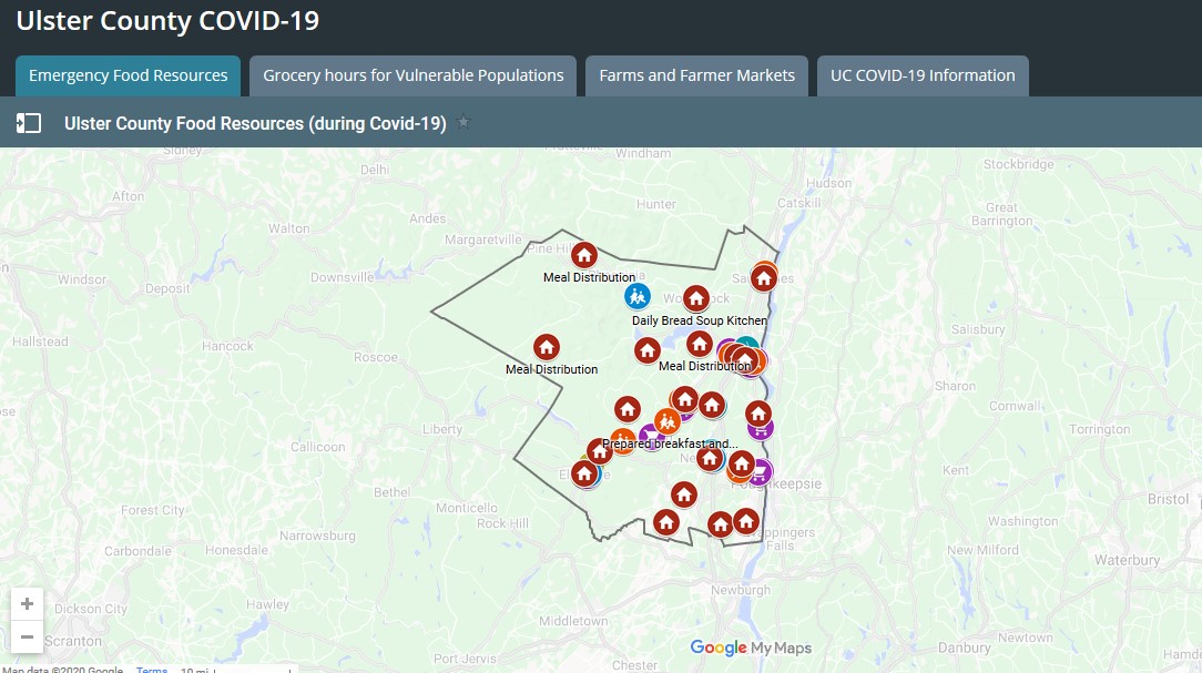
 Rock, who is also the co-founder of the College’s Digital Arts, Sciences & Humanities (DASH) Lab, applied her technical expertise to create a map of Emergency Food Resources for Ulster County using data she gathered from Ulster County’s government and k-12 school district websites.
UlsterCorps and other regional non-profits have contributed to the map, helping to produce an up-to-the-minute resource with information about where to acquire groceries, fresh produce, prepared meals and balanced meals for children.
“As the economic impacts from COVID-19 take their toll, knowing how to access emergency resources is crucially important,” said Rock.
Rock’s contributions are now featured on a multi-map resource site for Ulster County that displays data on COVID-19 infections alongside things like grocery hours for vulnerable populations and farms and farmer’s markets providing food and delivery services.
Determined to make the map as accessible as possible for those in need, Rock has also created an instructional video to help users navigate the map.
Agencies interested in contributing to the map can add new submissions using this form.
For more information, visit Ulster County’s COVID-19 resources online.